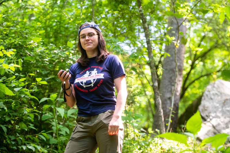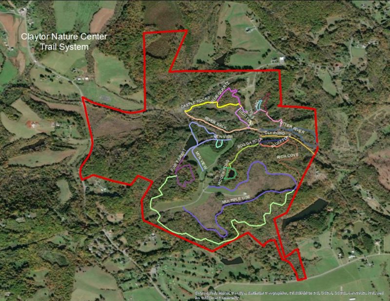
Visitors to the University of Lynchburg’s Claytor Nature Center will soon have access to digital maps of the property’s hiking trails, thanks to Maggie Kicklighter ’24 and a $2,000 grant from the Virginia Foundation for Independent Colleges.
Kicklighter, a Westover Honors Fellow and environmental sciences and sustainability major from Lynchburg, Virginia, had been looking for an opportunity to use what she learned last fall in Dr. Dave Perault’s Introduction to GIS class.
“I really enjoyed it,” Kicklighter said of the class, which gives students an introduction to geographic information systems, or GIS. “I wanted to do more with the skills I had learned and get experience working on actual projects, instead of practice problems and lab assignments.”

As luck would have it, Claytor staff wanted to map their 491-acre property, which includes, among other things, 8 miles of hiking trails. So, when Kicklighter approached Perault this past semester, asking about research opportunities, he had just the job for her.
“There’s been sporadic work on the mapping of Claytor Nature Center since the property was acquired in 1988,” Perault, a biology and environmental science professor, said. “This has generated a need to revisit and organize all of the spatial data and create new maps showing trails and other features of interest.
“Jennifer Wills, director of Claytor, has been ‘bugging’ me … to tackle this project. When our School of Sciences dean … put out a call for VFIC research proposals this past spring, I knew the time had come.”
The grant, “What Makes an Effective Map? Or, Getting Lost at Claytor,” provided a $1,000 stipend for Kicklighter. It also funded GPS equipment and gas for the roughly 25-mile drive to and from Claytor, which is located in Bedford County.
“Our goal is to have interactive maps available online to the public,” Perault said. “In addition to links from Claytor’s main webpage, we would have a map at the parking area with a QR code that folks could scan with their phones to pull up the online maps.
“That will all be developed later.”

The Claytor project wasn’t Kicklighter’s first experience using GPS technology. In Wyoming last summer with Dr. Brooke Haiar’s dinosaur dig class, she used it to “mark waypoints of different rock formations.”
She also completed an online workshop with Esri, an industry leader in GIS, and attended the virtual annual meeting of the Geospatial Mid-Atlantic Users Group. The “big skill” she learned at Claytor, however, was how to use the GPS unit.
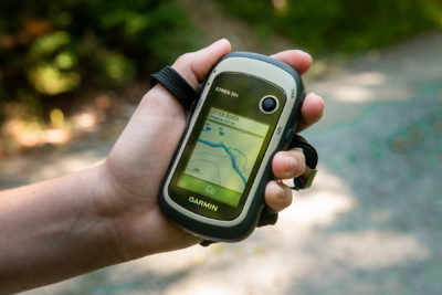
“It’s a small handheld unit that has a bunch of features, but I mainly used it to mark waypoints and track trails,” Kicklighter said. “I practiced marking trails in my neighborhood before using the GPS at Claytor.
“The main thing you have to be aware of is to start and stop recording with the GPS at the correct points. [It] continuously tracks your walking progress unless you turn off that feature, so you have to make sure you’re not including extraneous steps between different trails.”
Working on the project also taught Kicklighter to ask questions — lots of them. “This is Dr. Perault’s project, but we’re making the map for Claytor Nature Center,” she said. “I made sure to be very clear about what exactly Claytor wanted for the map so I could gather all the data necessary to make that vision come true.”
Kicklighter spent about six hours hiking and more time, over the next two weeks, collecting and processing data. Aside from one snake encounter and a few ticks, she said “everything else was super easy. The trails are really well kept, so it was easy to navigate them.”
One day, Perault joined her on the trails — a meaningful gesture for Kicklighter. “Claytor is about 45 minutes away from Lynchburg, so it was cool that he took the time [out] of his day to come out and map trails,” she said.
Otherwise, Perault left the project to her. “Maggie has been instrumental in data collection,” he said. “Our GPS is brand new, so I simply handed it to her and let her break it in, and then teach it to me!
“She is compiling a cheat-sheet instruction manual for future use by other students. I could not be more impressed by her work, especially her degree of independence.”
Kicklighter isn’t sure what she’ll do next year, after graduating from Lynchburg. She’s currently weighing two options: graduate school or working in a lab. Whichever route she takes, she said her experience at Claytor will be an asset.
“GIS is a really useful tool, especially in environmental science research, because it can help [you] visualize the areas where research is taking place,” she said. “Although GIS continues to grow in popularity, a lot of people still don’t use it in their day-to-day research.
“I bring my skill set of using GPS and importing that data into GIS software to help make research clearer, whether it’s in a graduate school or professional setting.”
Shortly after she finished mapping Claytor, Kicklighter left Lynchburg for a two-month trip to Costa Rica with Dr. Tom Shahady, professor of environmental science and director of Lynchburg’s Center for Water Quality.
Under a $299,259 grant from the National Science Foundation, she and other students will research the water quality of three rivers near the coastal city of Quepos.
“The ultimate goal is to determine how the water quality in each river changes from the headwaters in the mountains down the slope to the ocean — how land use affects the water quality,” she said.
“We also want to see how the water quality predictions made using the macroinvertebrates in the rivers compare to the water quality parameters measured.”

